The Run Larapinta Stage Race will be conducted along some of the most spectacular sections of the famed Larapinta Trail in the MacDonnell Ranges near Alice Springs in Central Australia. Stretching a total of 223km from the Old Telegraph Station to Mt Sonder in the West, the Larapinta Trail is an incredible journey through a timeless landscape. We pick out the best and most accessible sections of the trail for the race.
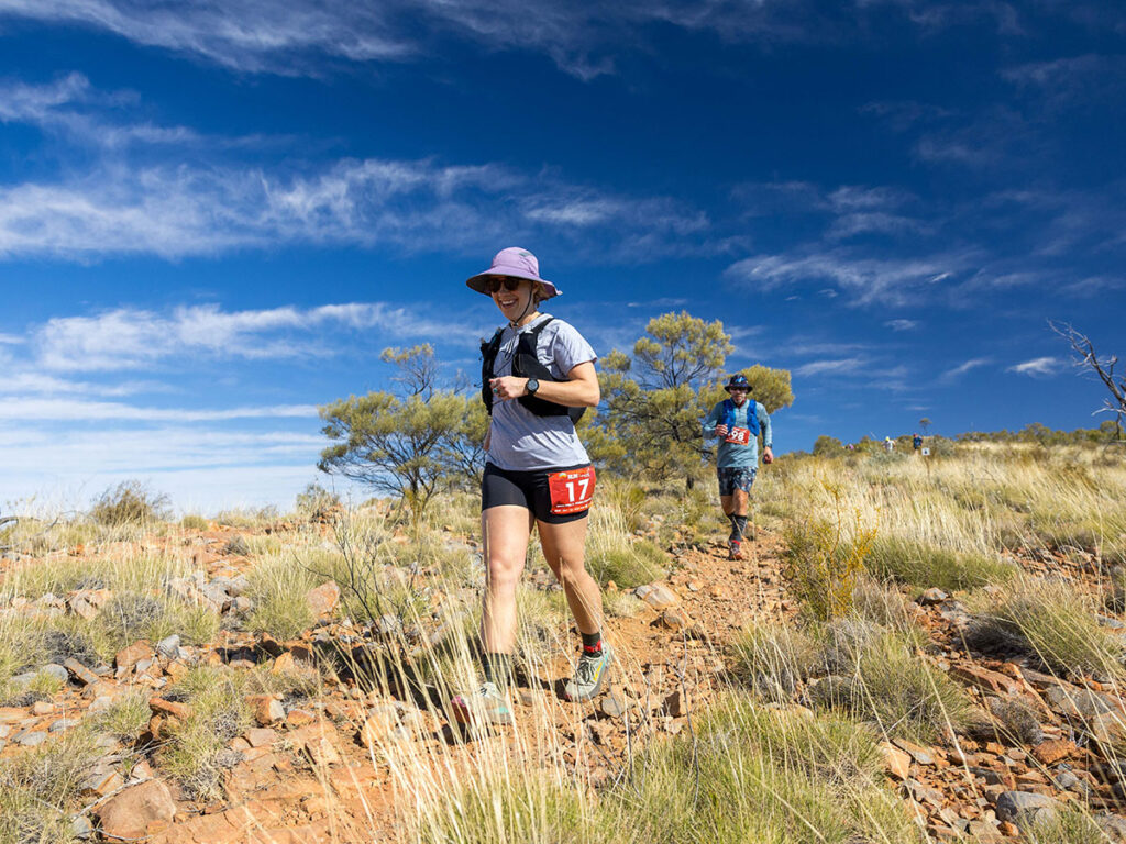
Each stage passes through an incredibly diverse range of landscapes that will challenge and inspire all runners:
- Steep sided, red rocky gorges often with waterholes in the bottom
- Rocky ridge tops providing views to the edge of the earth
- Dry savannah country filled with wildflowers
- Wide valleys with steep rocky mountain ridges and summits all around…

“The best part was sharing the experience of running through those spectacular landscapes with my partner & all the friendly runners & event crew!” – 2023 participant
“One of the most enjoyable and challenging experiences in my life. At sixty four, I have proved to myself I can take on difficult challenges that require both mental and physical toughness and enjoy. The scenery and trails were like none other and so diverse. The comradeship of the other competitors and the event organisers left you feeling like you had been friends forever.” Robyn, 2019 participant
Two race distances
The Run Larapinta Stage Race includes stages of two different lengths so runners can select the set of stages that matches their running ability and objectives.
The Malbunka
These stages are longer and pass through slightly more demanding terrain. Best suited to more experienced runners looking for a bigger challenge. Entry requirements apply.
VIEW DETAILED MALBUNKA STAGE DESCRIPTIONS AND MAPS
The Namatjira
These stages are shorter and more accessible for runners of all fitness levels and whilst still passing through some remote and spectacular terrain, they are a little easier than the Malbunka Stages.
VIEW DETAILED NAMATJIRA STAGE DESCRIPTIONS AND MAPS

“An awesomely beautiful but physically difficult event/race that will push you to your limits.” 2023 participant.
Trail textures and terrains
All runners should be prepared for the conditions on the trail and have footwear and clothing to match. There is a lot of variety along the trail with some sections being made up of nice crushed rock that is not too technical, through to other sections that are very rough, rocky and sharp – making them unrunnable. The trail provides tough conditions for shoes both in terms of tread and cushioning as it is always hard and harsh under foot.
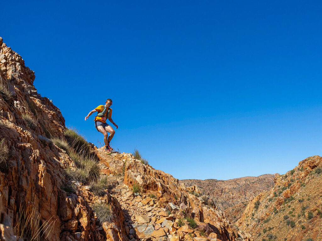
Large sections of the route are in mountainous country that will see you going up hillsides, and along the top of rocky ridges before descending to more open savannah on the other side. There are tow sections where people who suffer vertigo sometimes have difficulty: On day 2 there is a short ‘rock climbing’ section about 7m high and on day 3 there is a narrow ledge above a steep slope that all runners must navigate. Be prepared for these sections, assk help from the other runners around you and believe in yourself – you CAN do it!.
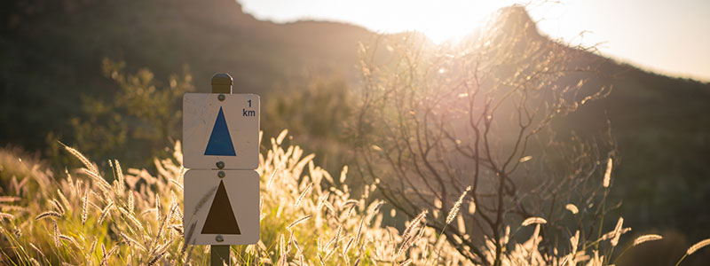
Trail marking
The entire Larapinta Trail is very well marked with National Parks arrows and signs leaving little, if any, doubt on where to go. There will basically be very little additional course markings put in place by Rapid Ascent other than when you arrive into a finish area and when we need you to go a specific way. The National Parks markings are quite frequent, but runners must remain aware and alert for the markings at all times and follow the main route as marked.
The courses for each race will utilise these National Parks arrows and runners will not need a map to navigate your way along the trail. You do need to be aware of your surroundings. It is mandatory to carry GPS files of the course maps on your phone so you have something to refer to whilst out on the trail and for usage in an emergency.
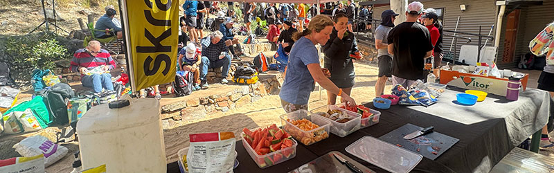
Water points, checkpoints and marshals
Water Points will be established along the courses for all stages but may still be 20-30km apart so runners will definitely need to carry water with you whilst on the trail. These Water Points will be manned and will double as emergency access points with marshals with radios and / or satellite phones.
Water Points will have water and sports drink products that allow you to refill your bladders and bottles.
There will be some food at Water Points – eg. Skratch sports drink, fruit, cake, chips, snakes and lollies – but we encourage you to be self-sufficient for nutrition to get you from the start to the finish.
For some stages it will be mandatory for runners to leave the start and/or subsequent Water Points with a minimum amount of water (such as 3lt) to ensure you have enough to get you to the next Water Point or stage finish.
Check the mandatory gear list for the minimum amounts of water you MUST carry prior to departing various start lines/checkpoints.